


Topography APP
Deskripsi Topography APP
The Topography APP is an excellent application for georeferencing or land surveying, design of electrical networks, avenues, streets, subdivisions and studies in general.
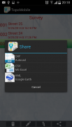
Export your surveys to DXF (Autocad), KML (Google Earth), CSV (MS Excel) without the slightest difficulty and the possibility of transmission by email of their withdrawals directly from the field to the office.
In the Professional version you can mark up to 5000 points for surveys.</div> <div jsname="WJz9Hc" style="display:none">The Topografi APP adalah sebuah aplikasi yang sangat baik untuk georeferencing atau tanah survei, desain listrik jaringan, jalan, jalan-jalan, subdivisi dan studi pada umumnya.
Ekspor survei ke DXF (Autocad), KML (Google Earth), CSV (MS Excel) tanpa kesulitan sedikitpun dan kemungkinan penularan melalui email dari penarikan mereka langsung dari lapangan ke kantor.
Dalam versi Professional Anda dapat menandai hingga 5000 poin untuk survei.</div> <div class="show-more-end">
Topography APP - Versi 2.3.4
(16-05-2020)Topography APP - Informasi APK
Versi APK: 2.3.4Paket: aguiar.com.br.point_gpsVersi Terakhir dari Topography APP
Versi lain


 4.15
4.15


Aplikasi pada kategori yang sama

Anda juga mungkin suka...
 4.042.654.133.78
 4.734.11
Aplikasi pada kategori yang sama


